UPDATE, September 2022: The Amazon project mentioned in this article has been cancelled. The property in question is no longer under imminent threat, but it is still being offered for sale.
When we lose a loved one, it is sometimes said in comfort that they will continue to be with us as long as we remember them. Similarly, in the case of a dead town, even after its living memory has long since lapsed, it might linger on in its own absence — perhaps through the continued use of a place name, the passing-down of oral legend, or the persistence of wooded hills and feral fallows, cloaking mysterious features that only the legend can explain.
On these terms, a ghost town acquires in death an elevated status that is threatened only by the prospect of its rebirth. Modern development is the most tragic fate it can suffer — lost once to the present, and now to the past, its resurrection as a legend finally proves false, as its aura of mystery and imagination is smothered by the resurgence of prosaic pursuits.
Perhaps it will simply be sequestered under the forgetful asphalt of a parking lot. Or, less mercifully, it might be dismembered into an ant colony of cul-de-sacs, its air of intrigue drowned out by a droning chorus of compulsively mown lawns, code-compliant curb cuts and gaping garages. Transformed beyond recognition, such places are stripped of their context and authenticity, so much so that they become infertile to imagination and unlikely to form any comparable history of their own.
Slipping away
As I wrote in another article, the legend of Rawsonville’s time as a real town has benefited from some mild exaggeration, by which it manages to remain embedded in the origin story of the local area. In a follow-up article, I reported on an excursion to visit a mysterious stone chimney on a portion of the site that had enjoyed a century of benign neglect, noting that the heavily wooded, hundred-acre tract had been placed on the market, and wondering if it was poised to become a tract of McMansions.
Sadly, it has now come to light that its fate is sealed by a tragedy of another sort. This forest now belongs to the Amazon — corporation, that is. The southwest quarter of the platted extent of Rawsonville, as well as the mature riparian forest that has grown upon it, will become yet another gargantuan distribution center. At some time very soon, before it is graded down, paved with meticulously striped asphalt, crowned with a windowless warehouse, and finally populated with a hive of worker bees — who will be dreaming of McMansions of their own — over 1,500 trees will be removed without ceremony, replacement, or regret. In what could pass as a cynical act of mockery if it were not just evidence of the tone-deaf detachment that accompanies corporate growth of this sort, someone at Amazon has code-named this incursion “Project Yoga”.
Knowing now its fate, I found myself distracted by the pending destruction of this sprawling tract. On my daily drives past the area, I began to look for features that I perhaps had never noticed before, and had better notice soon, before they are consumed.
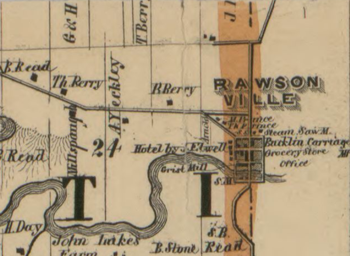
My previous article explored the layout of old Rawsonville in depth. Save for a sawmill on the river, the southwest quarter of the originally platted town, pictured below, was never developed or settled as its founders had speculatively hoped. The boundaries of dozens of lots bordered by the never-built Mill Street, Cass Street, Lafayette Street, and Van Buren Street existed only in the State of Michigan’s land claim files.
Seen in a new light
Owing to the lack of historical settlement, it seemed at first that nothing tangible of old Rawsonville might be lost to “Project Yoga.” However, one unexpectedly snowy day in late spring, I did notice something as I drove past. It seemed to be a trace of an abandoned road, that once had climbed gradually out of the valley toward the southwest, forming a ramp along the east face of the old river bank that parallels Rawsonville Road. Highlighted by a new dusting of snow, it briefly became visible in relief, its straightness contrasting with the curving crest of the hill. This was clearly a manmade thing, and it seemed to be going somewhere.
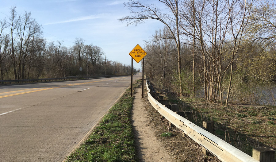
The ghostly ramp was only visible from a stretch of road that is very inconvenient for photography. There is absolutely no place to stop a car on this busy, shoulderless highway, and pedestrian access is effectively prevented by a guardrail that crowds the curb. Clicking the shutter rapidly as my car sped by, I managed to capture a reasonable photo through the passenger side window. Seen below, I have placed two orange arrows to help identify the long, straight roadbed that briefly becomes visible under these conditions.
I thought back to my earlier research on Rawsonville. I had noticed that early maps indicated that Rawsonville Road, the north-south artery that bisects the site, was not initially laid out in a straight line as it is today, but veered near the location of this ramp. Could this be where it veered?
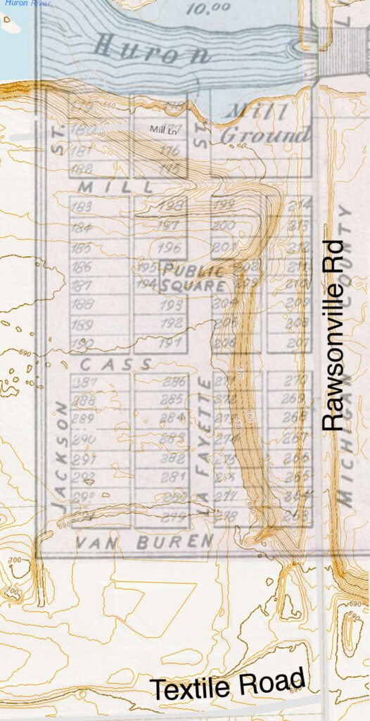
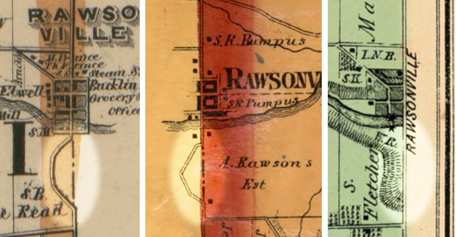
Consider the maps below, dated 1856, 1860, and 1874, respectively. In the first two maps, we see a mysterious crook (highlighted) in what became today’s Rawsonville Road. It seems to be swerving to avoid something, before meeting up with its original course some distance away. But in the rightmost map, from 1874, the crook has disappeared, and the road is straight, as it is today — suggesting that whatever the road was avoiding had been engineered away by then, so that the road could follow the county line as intended.
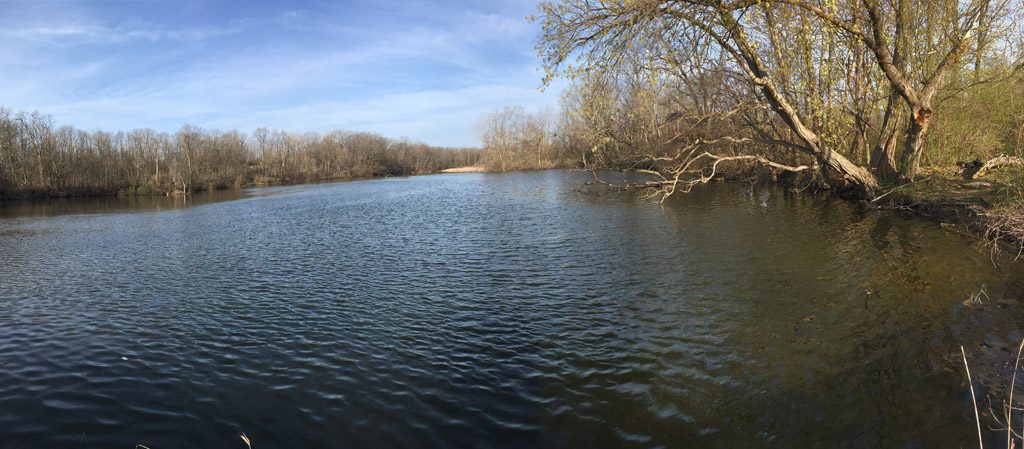
Below, by comparing the earlier maps with a modern relief map at right, we can see what the earlier maps were trying to express. Historically, the area immediately south of Rawsonville consisted of marshy sloughs, where the Huron River had formerly flowed through a bend, creating a couple of oxbow lakes and a very steep river bank. Today the south bank has been graded and filled, allowing a straight approach, but early settlers seeking to travel south would have sought to avoid the marsh and the steep bank by gradually climbing out of the valley along the east-facing flank of the river bank, and then following its arc along the top. In the relief map below, we can see the situation.
So, I would speculate that the ramp I was seeing could be that crook in old Rawsonville Road — abandoned 150 years ago, but continuing to reveal itself as an apparition, on certain snowy mornings.
Could an abandoned wagon trail really have persisted on the side of a soggy, earthen river bank for so long a time? Or was it something else — perhaps just a natural feature, teasing my wishful imagination with a trick of the morning light?
It was time to go and see for myself.
The peak of my curiosity coincided with the first perfect day of the gathering springtime. Having awakened early on a Saturday morning, I poured the lagging half of my morning coffee into a thermos, just as the sun began creeping in horizontally through the blinds. I got in the car, drove over, and scoped out the area for a place to park.
On the west side of Rawsonville Road at the river, there is a dirt strip accessible from Snow Road where generations of fishermen plying the Huron River for crappie and bluegills have parked before proceeding to the river bank nearby, poles and gear in tow. I mentally took on the guise of a fisherman as I parked and exited the car, although the lack of fishing gear might have made me conspicuous to a keen observer. From there I followed a well-worn footpath across the bridge, not to a secret fishing hole, but to more intriguing prospects.
It was one of those early spring days when a greenish tinge had already begun to paint the awakening forest in a blush of moss and spring ephemerals, channeling the sanguine essence of a gathering summer. The gray of winter had largely been chased back into the bark of the dormant oaks, now darkened to a leathery brown with moisture and anticipation. As traffic barrelled down the highway only inches from my left elbow, ordinarily I would have felt that it was angrily hazing me for my unexplained and eccentric presence. But on this lazy morning, the traffic was light, and seemed to convey a more patient and understanding character. The footpath certainly did not want for wear, and so served as evidence that my presence could not be entirely unusual; I felt not hazed but perhaps a bit envied, that I might be free to walk such a path across a placid blue river on a glorious weekend morning.
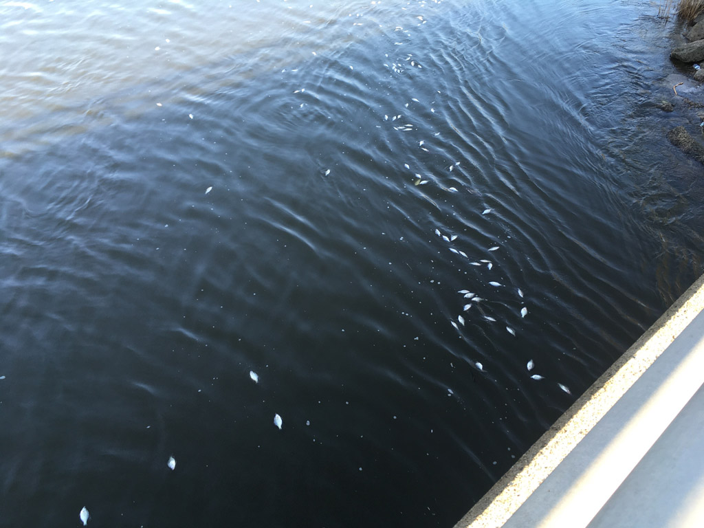
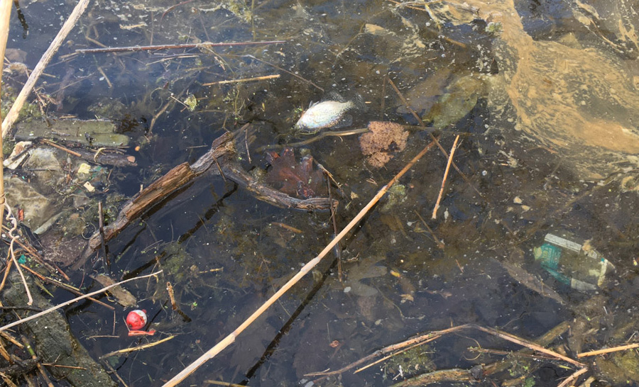
My bliss was brief. As I crossed the bridge, I was confronted by an endless procession of dead fish passing below, drifting on the current. Some were gasping and twitching, but most were clearly dead. As I stood there for several minutes, the procession showed no sign of letting up. Thousands must have already passed, with thousands to come. All appeared to be the same size and species, but I could not get close enough to identify which species. Powerless from my position as an observer on a highway bridge, ultimately I could do no more than shrug my shoulders and proceed to the destination. Hopefully, somebody will fix this soon.
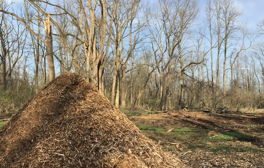
Now across the bridge, I came to the public right-of-way known as Mill Lane. As I explained in another article, I know this lane and the land on each side to be publicly owned, rendering the railroad’s misplaced No Trespassing sign invalid. Generations of fishermen have demonstrated the same. Recently, the Ypsilanti Community Utility Authority, which controls much of the public land in the area, was doing work here to address a sewer issue. However, I’m not sure why it was necessary to clear-cut and chip the trees on this spot. Something’s probably coming to accompany the still-mysterious chimney that I wrote about in a previous article. It’s not appearing quite as mysterious these days, and definitely getting a lot more sun.
I wondered what the tree removal crew thought when they encountered the chimney in what was supposed to be just a thicket of shrubbery. It wasn’t a tree, couldn’t be chainsawed, and wouldn’t fit in the wood chipper, so they were powerless over it — and anyway, it wasn’t in the contract. Ominously, the chimney is now surrounded by a pile of trash that was collected from the area, suggesting that the chimney is destined for the landfill, too, as soon as the right crew arrives.
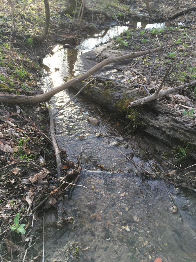
Turning south, I came to a small, bubbling stream, running swiftly from the heavy rains of the day before. Its clear water showcased a pristine bottom of smooth pebbles of every variety, seasoned with woody debris and other essentials for the spawning of crayfish and migratory minnows. I had to remind the child within me, who desperately wanted to return with a net, that he has outgrown such pursuits – but I thanked him for reminding me.
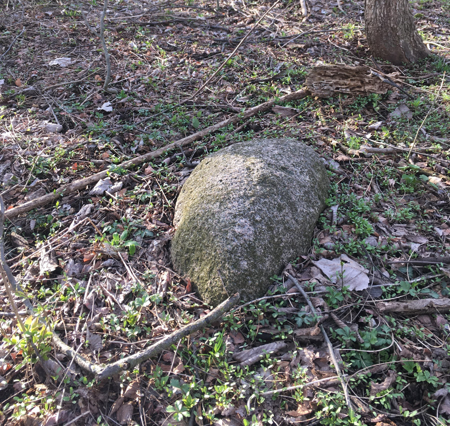
Climbing then a steep hill, I did not encounter any property markings, barriers, or signs, but came to a plateau of sorts, littered with the detritus of a healthy forest. Here and there, the presence of glacial erratics, such as the small boulder below, suggested that this land might never have been subjected to farming or other development. If so, it would be a rare holdout in this densely populated area, and worth infinitely more as a relatively undisturbed example of Michigan riparian and lowland forest than as an industrial site. It is a tragedy that this tract has not been acquired by a public authority. Ypsilanti Township could attract countless visitors to a world-class public forest preserve, if combined with the similarly-sized North and South Hydro Parks to the west and across the river.
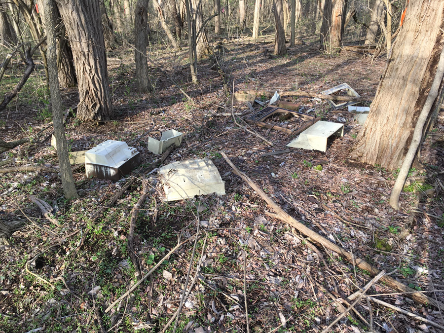
I also encountered other kinds of erratics. Here, we see that somebody chose this spot to relieve themselves of possession of several 1970s television sets. Perhaps it was another errant visitor who smashed them to bits. From the looks of it, this two-act play probably wrapped up its performance 30 or 40 years ago, since there is no trace of the driveway that the car bearing these items could have driven upon. The persistence of this scene is a monument to the persistence of plastic.
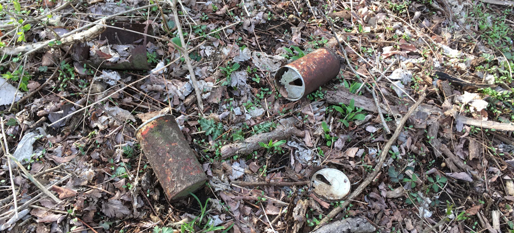
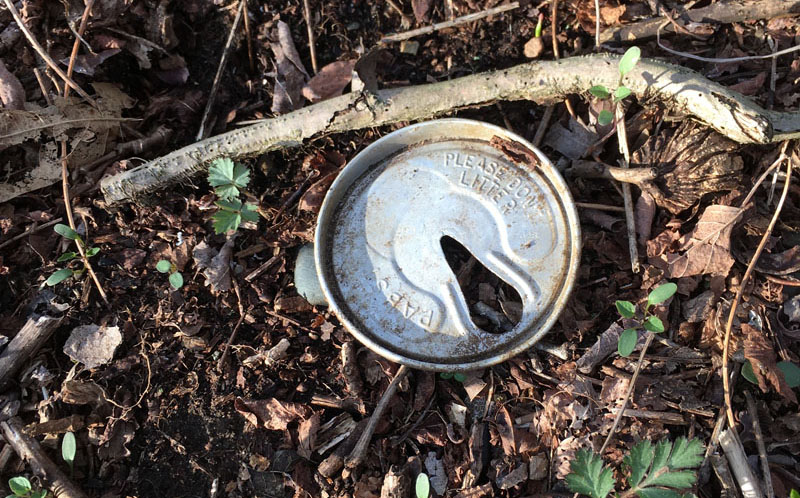
In contrast, much of the other trash I encountered was well on its way to becoming part of the soil. Beer cans were in surprising abundance. In many cases the steel portion of the can had entirely rusted away leaving only the aluminum top and, in some cases, only a portion of that. These were probably left by hunters over the years.
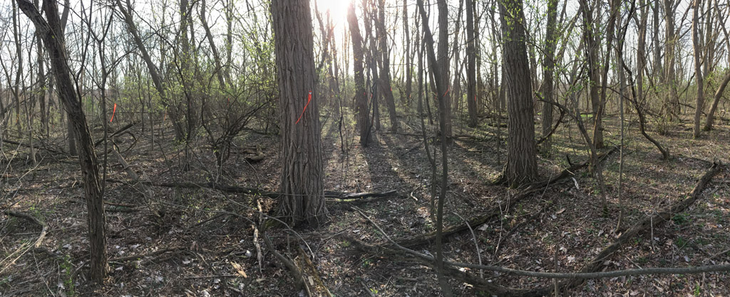
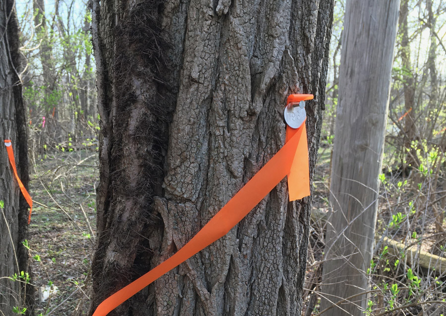
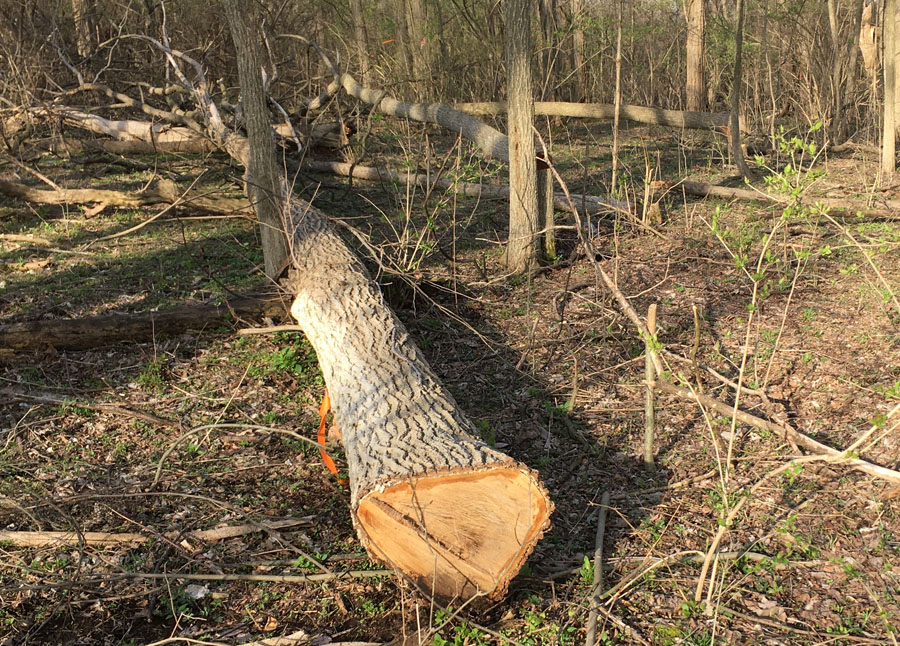
All over this area, and for as far as I could see in the undergrowth, many of the larger trees were brightly ribboned and numbered with a metal tag. Presumably the purpose was to count the significant trees and their diameters, so that Amazon could quantify the destruction for the purpose of whatever mitigation the township might require, which usually would be expressed in terms of equivalent diameter of the trees removed. Apparently, the township isn’t even requiring much of that. Recent news reports in local media, dedicated largely to cheering the project along, suggest that very few of the trees will be replaced. In my opinion this exercise of mitigation theater amounts to little more than a face-saving apology, on the part of both the purchaser and the complicit township. Quite literally, neither entity can see the forest for the trees. But then, such is one of the key vulnerabilities of modern industrial society. Will we overcome it, before it overcomes us?
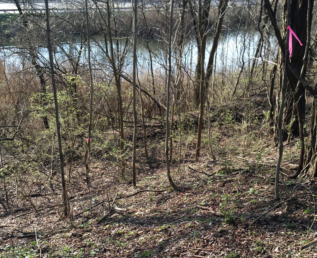
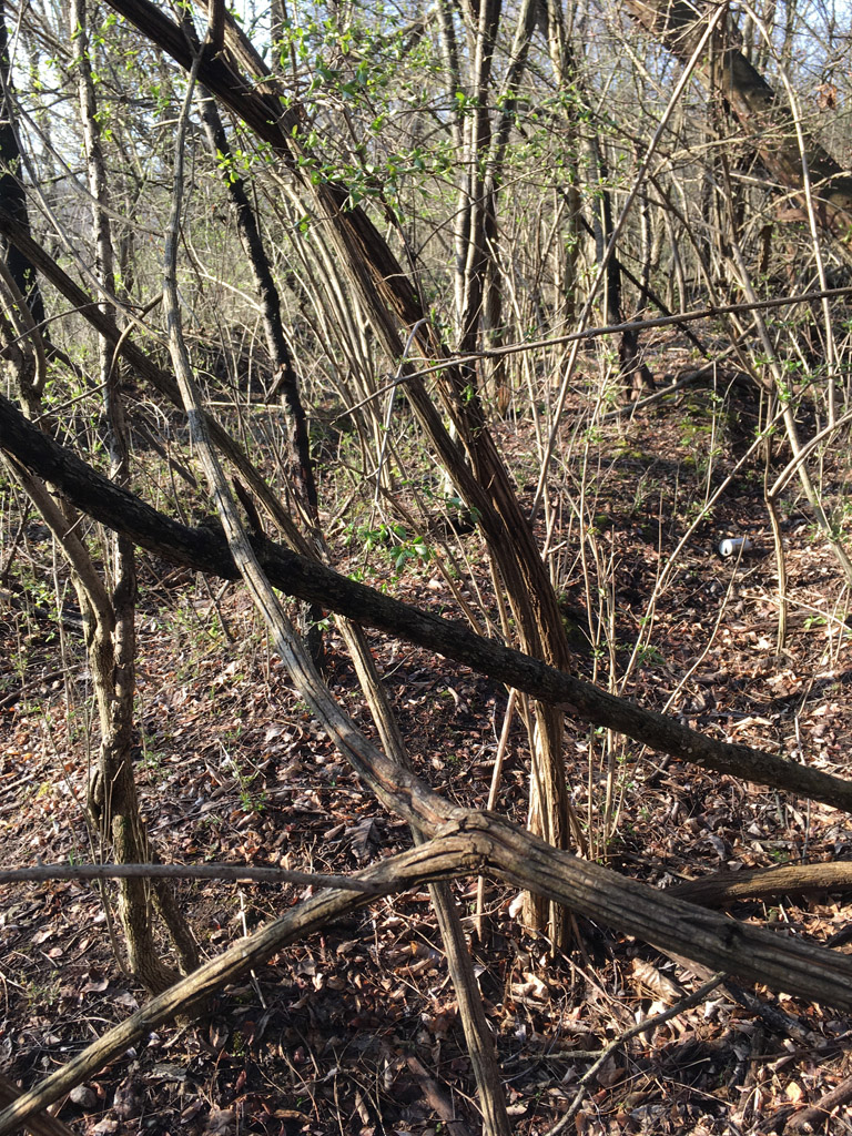
Finally I neared the crest of the river bluff, where I expected to acquire a view of the abandoned roadbed. I was pleased to be greeted first by a colony of May Apple, recently sprouted.

And just down the bank was the abandoned roadbed, exactly as I expected.
An earthwork on a forest floor is very difficult to capture in a two-dimensional image, and is much easier to see with binocular vision in real life. But it was quite distinct, and clearly visible in the slanted light of the morning. This view faces west-southwest down a slight embankment, toward the oxbow lake and Rawsonville Road.
Although its trace was subtle, there was a distinct linear trough at both sides of the roadway that clearly delineated the path of the road. Of course, it was covered thickly with trees, some fairly large, but not as large as might be suggested by an abandonment of 150 years. For all we know, the roadbed might have continued to be used for some time by the owner of the property, or the tract might have been logged, or the natural mortality of trees on a soggy hillside might have kept the survivors relatively small. It’s hard to understand how this history could ever be determined, as these things rarely get recorded. We can only interpret what we see, and assign a plausible explanation, of which there are many. Perhaps this is why places like this provoke the imagination, much more so than after they are tamed and reclaimed.
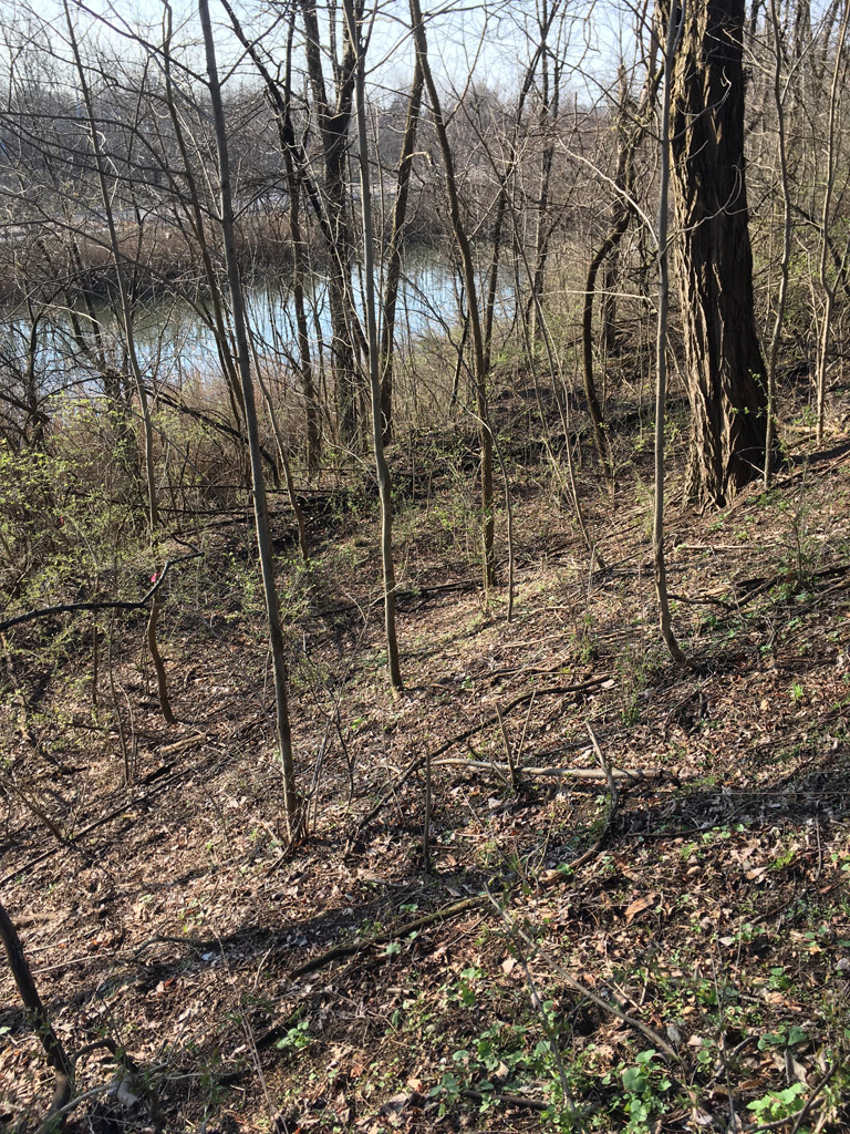
I followed the path uphill for a short distance, until the undergrowth became too thick to proceed. Further uphill, the edges of the road seemed to have dug deeper, until the center of the road had become a long, linear mound. I would speculate that this was the result of gradual erosion over the decades.
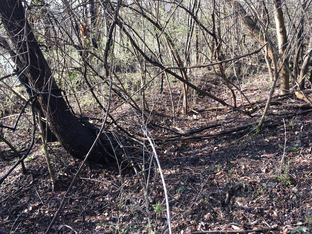
Having satisfied my curiosity, I turned back. Below, we see several trees that, although they are tagged, have already been cut. I had been holding out hope that the tagging indicated those that were to be saved. But no, it seems that it is only for the purpose of documentation. As to why these specific trees were already cut, I can only speculate. Perhaps it was to clear a sight line for the surveyors, or a drag path to remove the debris. Hmmm. If they’re clever, they might clear that abandoned roadbed, and put it to use.
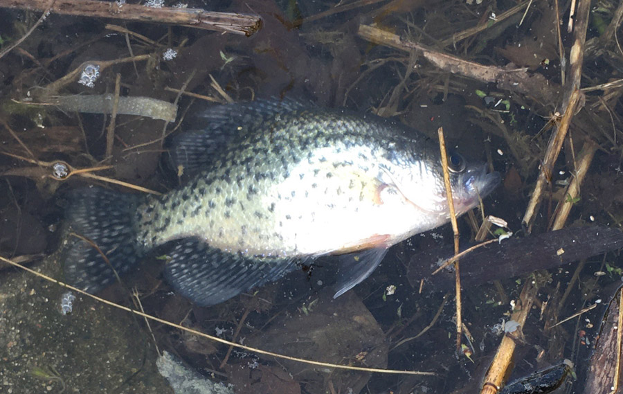
Exiting the forest, I crossed the bridge back to the car. The procession of dead fish was still underway. If you’ve not seen a fish kill before, here is the movie.
I noticed that a few of them had drifted to the shoreline under the bridge, and had become trapped among the pools formed by the rip-rap. I felt that if I could climb over the guiderail and clamber down, I might be able to get close enough to take a good photo and identify the species when I returned home.
As you might imagine, the wayside pools and eddies of a largely urbanized river are not a comely sight. A film of brown scum floated over a scattering of sunken plastic trash and lost fishing gear, now fittingly accented by several expired fish. I managed to climb down close enough to grab a dry reed of invasive Phragmites australis and use it to nudge one of the fish into camera range. I would guess that it’s either a bluegill or a crappie. So far, I have seen no word, speculation, or even evidence of awareness of this fish kill event among the weak voices of the local media.
So, what significance today, of an abandoned roadway that might have last been traveled 150 years ago? I suppose it’s debatable. Some things appeal to some imaginations and not to others. This one appeals to mine. The fact that it only becomes visible in certain rare conditions gives it something of the character of a ghost. The impression that perhaps I was the only one noticing it was also somehow intriguing. These alone might not have inspired an excursion to view the site, but news of its possible destruction forced the situation.
Once again, I was shown that one cannot observe the world vicariously from a car and expect to truly understand it. You have to stop, park, and get your boots dirty. And then, you will know more than 99.9 percent of the people who are satisfied with merely driving past.
Once out of the car, I encountered a much more detailed image of what I already knew to be beautiful. In that detail I also found that every beautiful image seemed to offer a counterpoint, speaking of various facets of our society’s failings. From a car, we see the photogenic forest, but not the garbage that has been strewn about it, by both our contemporaries and our forebears. From a car, we see the placid blue of a river framed by picturesque willows, but not the fouled eddies, or even the occasional, unexplained procession of dead and dying fish.
Powerless, of course, are we as individuals, to change such things merely by having caught sight of them. As a society, we seem to be that person standing on the bridge above the river, shrugging our shoulders, and then moving on to other things. Perhaps that’s the best we can do.
Article and photos Copyright 2022 by the author.


One Comment
Pingback: